This function defines the areas surveyed by receivers (termed `detection containers') as a spatial object, based on an estimate of the detection range (m) and any barriers to detection. To implement the function, receiver locations must be supplied as a SpatialPoints or SpatialPointsDataFrame object with the Universe Transverse Mercator coordinate reference system. The function defines a spatial buffer around each receiver according to the estimated detection range, cuts out any barriers to detection, such as the coastline, and returns a SpatialPolygons object that defines the combined detection container across all receivers or receiver-specific detection containers.
get_detection_containers(
  xy,
  detection_range = 425,
  resolution = 1000,
  boundaries = NULL,
  coastline = NULL,
  plot = TRUE,
  ...
)
Arguments
- xy
A
SpatialPoints-classorSpatialPointsDataFrame-classobject that defines receiver locations. The coordinate reference system should be the Universe Transverse Mercator coordinate reference system.- detection_range
A number that defines the detection range (m) of receivers.
- resolution
A number that defines the number of linear segments used to approximate the detection container (see the
quadsegsargument ingBuffer).- boundaries
An
extentobject (on an object from which this can be extracted) that defines the boundaries of the study area.- coastline
(optional) A
SpatialPolygonsDataFrame-classobject that defines barriers (such as the coastline) that block receivers from surveying areas within their detection range.- plot
A logical input that defines whether or not to plot receivers, their containers, and the buffer (if specified).
- ...
Additional arguments passed to
gBuffer, such asbyid.
Value
The function returns a SpatialPolygons-class object of the detection containers around receivers that represents the area they survey under the assumption of a constant detection range, accounting for any barriers to detection. By default, this will contain a single feature, which is suitable for the calculation of the total area surveyed by receivers (see get_detection_area_sum) because it accounts for the overlap in the detection ranges of receivers. However, if byid = TRUE is passed via ... to gBuffer, the returned object will have a feature for each pair of coordinates in xy (i.e., receiver). This is less appropriate for calculating the area surveyed by receivers, since areas surveyed by multiple receivers will be over-counted, but it is suitable when the containers for particular receivers are required (e.g., to extract environmental conditions within a specific receiver's detection range) (see get_detection_containers_envir).
Examples
#### Define receiver locations as a SpatialPoints object with a UTM CRS
proj_wgs84 <- sp::CRS(SRS_string = "EPSG:4326")
proj_utm <- sp::CRS(SRS_string = "EPSG:32629")
xy <- sp::SpatialPoints(
dat_moorings[, c("receiver_long", "receiver_lat")],
proj_wgs84
)
xy <- sp::spTransform(xy, proj_utm)
xy@data <- as.data.frame(xy)
#### Example (1): Get the simplest containers around receivers
get_detection_containers(xy)
#> Warning: GEOS support is provided by the sf and terra packages among others
 #> class : SpatialPolygons
#> features : 1
#> extent : 699188.2, 710830.8, 6249818, 6269562 (xmin, xmax, ymin, ymax)
#> crs : +proj=utm +zone=29 +datum=WGS84 +units=m +no_defs
#### Example (2): Account for barriers in the study area
get_detection_containers(xy, coastline = dat_coast)
#> Warning: GEOS support is provided by the sf and terra packages among others
#> Warning: GEOS support is provided by the sf and terra packages among others
#> Warning: spgeom1 and spgeom2 have different proj4 strings
#> class : SpatialPolygons
#> features : 1
#> extent : 699188.2, 710830.8, 6249818, 6269562 (xmin, xmax, ymin, ymax)
#> crs : +proj=utm +zone=29 +datum=WGS84 +units=m +no_defs
#### Example (2): Account for barriers in the study area
get_detection_containers(xy, coastline = dat_coast)
#> Warning: GEOS support is provided by the sf and terra packages among others
#> Warning: GEOS support is provided by the sf and terra packages among others
#> Warning: spgeom1 and spgeom2 have different proj4 strings
 #> class : SpatialPolygons
#> features : 1
#> extent : 699188.2, 710830.8, 6249818, 6269558 (xmin, xmax, ymin, ymax)
#> crs : +proj=utm +zone=29 +datum=WGS84 +units=m +no_defs
#### Example (3): Adjust the detection range
get_detection_containers(xy, detection_range = 400, coastline = dat_coast)
#> Warning: GEOS support is provided by the sf and terra packages among others
#> Warning: GEOS support is provided by the sf and terra packages among others
#> Warning: spgeom1 and spgeom2 have different proj4 strings
#> class : SpatialPolygons
#> features : 1
#> extent : 699188.2, 710830.8, 6249818, 6269558 (xmin, xmax, ymin, ymax)
#> crs : +proj=utm +zone=29 +datum=WGS84 +units=m +no_defs
#### Example (3): Adjust the detection range
get_detection_containers(xy, detection_range = 400, coastline = dat_coast)
#> Warning: GEOS support is provided by the sf and terra packages among others
#> Warning: GEOS support is provided by the sf and terra packages among others
#> Warning: spgeom1 and spgeom2 have different proj4 strings
 #> class : SpatialPolygons
#> features : 1
#> extent : 699213.2, 710805.8, 6249843, 6269536 (xmin, xmax, ymin, ymax)
#> crs : +proj=utm +zone=29 +datum=WGS84 +units=m +no_defs
get_detection_containers(xy, detection_range = 500, coastline = dat_coast)
#> Warning: GEOS support is provided by the sf and terra packages among others
#> Warning: GEOS support is provided by the sf and terra packages among others
#> Warning: spgeom1 and spgeom2 have different proj4 strings
#> class : SpatialPolygons
#> features : 1
#> extent : 699213.2, 710805.8, 6249843, 6269536 (xmin, xmax, ymin, ymax)
#> crs : +proj=utm +zone=29 +datum=WGS84 +units=m +no_defs
get_detection_containers(xy, detection_range = 500, coastline = dat_coast)
#> Warning: GEOS support is provided by the sf and terra packages among others
#> Warning: GEOS support is provided by the sf and terra packages among others
#> Warning: spgeom1 and spgeom2 have different proj4 strings
 #> class : SpatialPolygons
#> features : 1
#> extent : 699113.2, 710905.8, 6249743, 6269629 (xmin, xmax, ymin, ymax)
#> crs : +proj=utm +zone=29 +datum=WGS84 +units=m +no_defs
#### Example (4): Suppress the plot
get_detection_containers(xy, coastline = dat_coast, plot = FALSE)
#> Warning: GEOS support is provided by the sf and terra packages among others
#> Warning: GEOS support is provided by the sf and terra packages among others
#> Warning: spgeom1 and spgeom2 have different proj4 strings
#> class : SpatialPolygons
#> features : 1
#> extent : 699188.2, 710830.8, 6249818, 6269558 (xmin, xmax, ymin, ymax)
#> crs : +proj=utm +zone=29 +datum=WGS84 +units=m +no_defs
#### Example (5): Output characteristics are controlled via byid
# A SpatialPolygons object with one feature is the implicit output
sp_1 <- get_detection_containers(xy, coastline = dat_coast, byid = FALSE)
#> Warning: GEOS support is provided by the sf and terra packages among others
#> Warning: GEOS support is provided by the sf and terra packages among others
#> Warning: spgeom1 and spgeom2 have different proj4 strings
#> class : SpatialPolygons
#> features : 1
#> extent : 699113.2, 710905.8, 6249743, 6269629 (xmin, xmax, ymin, ymax)
#> crs : +proj=utm +zone=29 +datum=WGS84 +units=m +no_defs
#### Example (4): Suppress the plot
get_detection_containers(xy, coastline = dat_coast, plot = FALSE)
#> Warning: GEOS support is provided by the sf and terra packages among others
#> Warning: GEOS support is provided by the sf and terra packages among others
#> Warning: spgeom1 and spgeom2 have different proj4 strings
#> class : SpatialPolygons
#> features : 1
#> extent : 699188.2, 710830.8, 6249818, 6269558 (xmin, xmax, ymin, ymax)
#> crs : +proj=utm +zone=29 +datum=WGS84 +units=m +no_defs
#### Example (5): Output characteristics are controlled via byid
# A SpatialPolygons object with one feature is the implicit output
sp_1 <- get_detection_containers(xy, coastline = dat_coast, byid = FALSE)
#> Warning: GEOS support is provided by the sf and terra packages among others
#> Warning: GEOS support is provided by the sf and terra packages among others
#> Warning: spgeom1 and spgeom2 have different proj4 strings
 sp_1
#> class : SpatialPolygons
#> features : 1
#> extent : 699188.2, 710830.8, 6249818, 6269558 (xmin, xmax, ymin, ymax)
#> crs : +proj=utm +zone=29 +datum=WGS84 +units=m +no_defs
# A SpatialPolygons object with one feature for each element in xy
# ... can be returned via byid = TRUE
sp_2 <- get_detection_containers(xy, coastline = dat_coast, byid = TRUE)
#> Warning: GEOS support is provided by the sf and terra packages among others
#> Warning: GEOS support is provided by the sf and terra packages among others
#> Warning: spgeom1 and spgeom2 have different proj4 strings
#> Warning: GEOS support is provided by the sf and terra packages among others
#> Warning: spgeom1 and spgeom2 have different proj4 strings
#> Warning: GEOS support is provided by the sf and terra packages among others
#> Warning: spgeom1 and spgeom2 have different proj4 strings
#> Warning: GEOS support is provided by the sf and terra packages among others
#> Warning: spgeom1 and spgeom2 have different proj4 strings
#> Warning: GEOS support is provided by the sf and terra packages among others
#> Warning: spgeom1 and spgeom2 have different proj4 strings
#> Warning: GEOS support is provided by the sf and terra packages among others
#> Warning: spgeom1 and spgeom2 have different proj4 strings
#> Warning: GEOS support is provided by the sf and terra packages among others
#> Warning: spgeom1 and spgeom2 have different proj4 strings
#> Warning: GEOS support is provided by the sf and terra packages among others
#> Warning: spgeom1 and spgeom2 have different proj4 strings
#> Warning: GEOS support is provided by the sf and terra packages among others
#> Warning: spgeom1 and spgeom2 have different proj4 strings
#> Warning: GEOS support is provided by the sf and terra packages among others
#> Warning: spgeom1 and spgeom2 have different proj4 strings
#> Warning: GEOS support is provided by the sf and terra packages among others
#> Warning: spgeom1 and spgeom2 have different proj4 strings
#> Warning: GEOS support is provided by the sf and terra packages among others
#> Warning: spgeom1 and spgeom2 have different proj4 strings
#> Warning: GEOS support is provided by the sf and terra packages among others
#> Warning: spgeom1 and spgeom2 have different proj4 strings
#> Warning: GEOS support is provided by the sf and terra packages among others
#> Warning: spgeom1 and spgeom2 have different proj4 strings
#> Warning: GEOS support is provided by the sf and terra packages among others
#> Warning: spgeom1 and spgeom2 have different proj4 strings
#> Warning: GEOS support is provided by the sf and terra packages among others
#> Warning: spgeom1 and spgeom2 have different proj4 strings
#> Warning: GEOS support is provided by the sf and terra packages among others
#> Warning: spgeom1 and spgeom2 have different proj4 strings
#> Warning: GEOS support is provided by the sf and terra packages among others
#> Warning: spgeom1 and spgeom2 have different proj4 strings
#> Warning: GEOS support is provided by the sf and terra packages among others
#> Warning: spgeom1 and spgeom2 have different proj4 strings
#> Warning: GEOS support is provided by the sf and terra packages among others
#> Warning: spgeom1 and spgeom2 have different proj4 strings
#> Warning: GEOS support is provided by the sf and terra packages among others
#> Warning: spgeom1 and spgeom2 have different proj4 strings
#> Warning: GEOS support is provided by the sf and terra packages among others
#> Warning: spgeom1 and spgeom2 have different proj4 strings
#> Warning: GEOS support is provided by the sf and terra packages among others
#> Warning: spgeom1 and spgeom2 have different proj4 strings
#> Warning: GEOS support is provided by the sf and terra packages among others
#> Warning: spgeom1 and spgeom2 have different proj4 strings
#> Warning: GEOS support is provided by the sf and terra packages among others
#> Warning: spgeom1 and spgeom2 have different proj4 strings
#> Warning: GEOS support is provided by the sf and terra packages among others
#> Warning: spgeom1 and spgeom2 have different proj4 strings
#> Warning: GEOS support is provided by the sf and terra packages among others
#> Warning: spgeom1 and spgeom2 have different proj4 strings
#> Warning: GEOS support is provided by the sf and terra packages among others
#> Warning: spgeom1 and spgeom2 have different proj4 strings
#> Warning: GEOS support is provided by the sf and terra packages among others
#> Warning: spgeom1 and spgeom2 have different proj4 strings
#> Warning: GEOS support is provided by the sf and terra packages among others
#> Warning: spgeom1 and spgeom2 have different proj4 strings
#> Warning: GEOS support is provided by the sf and terra packages among others
#> Warning: spgeom1 and spgeom2 have different proj4 strings
#> Warning: GEOS support is provided by the sf and terra packages among others
#> Warning: spgeom1 and spgeom2 have different proj4 strings
#> Warning: GEOS support is provided by the sf and terra packages among others
#> Warning: spgeom1 and spgeom2 have different proj4 strings
#> Warning: GEOS support is provided by the sf and terra packages among others
#> Warning: spgeom1 and spgeom2 have different proj4 strings
#> Warning: GEOS support is provided by the sf and terra packages among others
#> Warning: spgeom1 and spgeom2 have different proj4 strings
#> Warning: GEOS support is provided by the sf and terra packages among others
#> Warning: spgeom1 and spgeom2 have different proj4 strings
#> Warning: GEOS support is provided by the sf and terra packages among others
#> Warning: spgeom1 and spgeom2 have different proj4 strings
#> Warning: GEOS support is provided by the sf and terra packages among others
#> Warning: spgeom1 and spgeom2 have different proj4 strings
#> Warning: GEOS support is provided by the sf and terra packages among others
#> Warning: spgeom1 and spgeom2 have different proj4 strings
#> Warning: GEOS support is provided by the sf and terra packages among others
#> Warning: spgeom1 and spgeom2 have different proj4 strings
sp_1
#> class : SpatialPolygons
#> features : 1
#> extent : 699188.2, 710830.8, 6249818, 6269558 (xmin, xmax, ymin, ymax)
#> crs : +proj=utm +zone=29 +datum=WGS84 +units=m +no_defs
# A SpatialPolygons object with one feature for each element in xy
# ... can be returned via byid = TRUE
sp_2 <- get_detection_containers(xy, coastline = dat_coast, byid = TRUE)
#> Warning: GEOS support is provided by the sf and terra packages among others
#> Warning: GEOS support is provided by the sf and terra packages among others
#> Warning: spgeom1 and spgeom2 have different proj4 strings
#> Warning: GEOS support is provided by the sf and terra packages among others
#> Warning: spgeom1 and spgeom2 have different proj4 strings
#> Warning: GEOS support is provided by the sf and terra packages among others
#> Warning: spgeom1 and spgeom2 have different proj4 strings
#> Warning: GEOS support is provided by the sf and terra packages among others
#> Warning: spgeom1 and spgeom2 have different proj4 strings
#> Warning: GEOS support is provided by the sf and terra packages among others
#> Warning: spgeom1 and spgeom2 have different proj4 strings
#> Warning: GEOS support is provided by the sf and terra packages among others
#> Warning: spgeom1 and spgeom2 have different proj4 strings
#> Warning: GEOS support is provided by the sf and terra packages among others
#> Warning: spgeom1 and spgeom2 have different proj4 strings
#> Warning: GEOS support is provided by the sf and terra packages among others
#> Warning: spgeom1 and spgeom2 have different proj4 strings
#> Warning: GEOS support is provided by the sf and terra packages among others
#> Warning: spgeom1 and spgeom2 have different proj4 strings
#> Warning: GEOS support is provided by the sf and terra packages among others
#> Warning: spgeom1 and spgeom2 have different proj4 strings
#> Warning: GEOS support is provided by the sf and terra packages among others
#> Warning: spgeom1 and spgeom2 have different proj4 strings
#> Warning: GEOS support is provided by the sf and terra packages among others
#> Warning: spgeom1 and spgeom2 have different proj4 strings
#> Warning: GEOS support is provided by the sf and terra packages among others
#> Warning: spgeom1 and spgeom2 have different proj4 strings
#> Warning: GEOS support is provided by the sf and terra packages among others
#> Warning: spgeom1 and spgeom2 have different proj4 strings
#> Warning: GEOS support is provided by the sf and terra packages among others
#> Warning: spgeom1 and spgeom2 have different proj4 strings
#> Warning: GEOS support is provided by the sf and terra packages among others
#> Warning: spgeom1 and spgeom2 have different proj4 strings
#> Warning: GEOS support is provided by the sf and terra packages among others
#> Warning: spgeom1 and spgeom2 have different proj4 strings
#> Warning: GEOS support is provided by the sf and terra packages among others
#> Warning: spgeom1 and spgeom2 have different proj4 strings
#> Warning: GEOS support is provided by the sf and terra packages among others
#> Warning: spgeom1 and spgeom2 have different proj4 strings
#> Warning: GEOS support is provided by the sf and terra packages among others
#> Warning: spgeom1 and spgeom2 have different proj4 strings
#> Warning: GEOS support is provided by the sf and terra packages among others
#> Warning: spgeom1 and spgeom2 have different proj4 strings
#> Warning: GEOS support is provided by the sf and terra packages among others
#> Warning: spgeom1 and spgeom2 have different proj4 strings
#> Warning: GEOS support is provided by the sf and terra packages among others
#> Warning: spgeom1 and spgeom2 have different proj4 strings
#> Warning: GEOS support is provided by the sf and terra packages among others
#> Warning: spgeom1 and spgeom2 have different proj4 strings
#> Warning: GEOS support is provided by the sf and terra packages among others
#> Warning: spgeom1 and spgeom2 have different proj4 strings
#> Warning: GEOS support is provided by the sf and terra packages among others
#> Warning: spgeom1 and spgeom2 have different proj4 strings
#> Warning: GEOS support is provided by the sf and terra packages among others
#> Warning: spgeom1 and spgeom2 have different proj4 strings
#> Warning: GEOS support is provided by the sf and terra packages among others
#> Warning: spgeom1 and spgeom2 have different proj4 strings
#> Warning: GEOS support is provided by the sf and terra packages among others
#> Warning: spgeom1 and spgeom2 have different proj4 strings
#> Warning: GEOS support is provided by the sf and terra packages among others
#> Warning: spgeom1 and spgeom2 have different proj4 strings
#> Warning: GEOS support is provided by the sf and terra packages among others
#> Warning: spgeom1 and spgeom2 have different proj4 strings
#> Warning: GEOS support is provided by the sf and terra packages among others
#> Warning: spgeom1 and spgeom2 have different proj4 strings
#> Warning: GEOS support is provided by the sf and terra packages among others
#> Warning: spgeom1 and spgeom2 have different proj4 strings
#> Warning: GEOS support is provided by the sf and terra packages among others
#> Warning: spgeom1 and spgeom2 have different proj4 strings
#> Warning: GEOS support is provided by the sf and terra packages among others
#> Warning: spgeom1 and spgeom2 have different proj4 strings
#> Warning: GEOS support is provided by the sf and terra packages among others
#> Warning: spgeom1 and spgeom2 have different proj4 strings
#> Warning: GEOS support is provided by the sf and terra packages among others
#> Warning: spgeom1 and spgeom2 have different proj4 strings
#> Warning: GEOS support is provided by the sf and terra packages among others
#> Warning: spgeom1 and spgeom2 have different proj4 strings
#> Warning: GEOS support is provided by the sf and terra packages among others
#> Warning: spgeom1 and spgeom2 have different proj4 strings
#> Warning: GEOS support is provided by the sf and terra packages among others
#> Warning: spgeom1 and spgeom2 have different proj4 strings
 sp_2
#> class : SpatialPolygons
#> features : 40
#> extent : 699188.2, 710830.8, 6249818, 6269558 (xmin, xmax, ymin, ymax)
#> crs : +proj=utm +zone=29 +datum=WGS84 +units=m +no_defs
# The total area of the former will be smaller, since areas covered
# ... by multiple receivers are merged
rgeos::gArea(sp_1)
#> [1] 16335577
rgeos::gArea(sp_2)
#> [1] 21992939
# But it can be more convenient to use the latter format in some cases
# ... because it is easy to isolate specific containers:
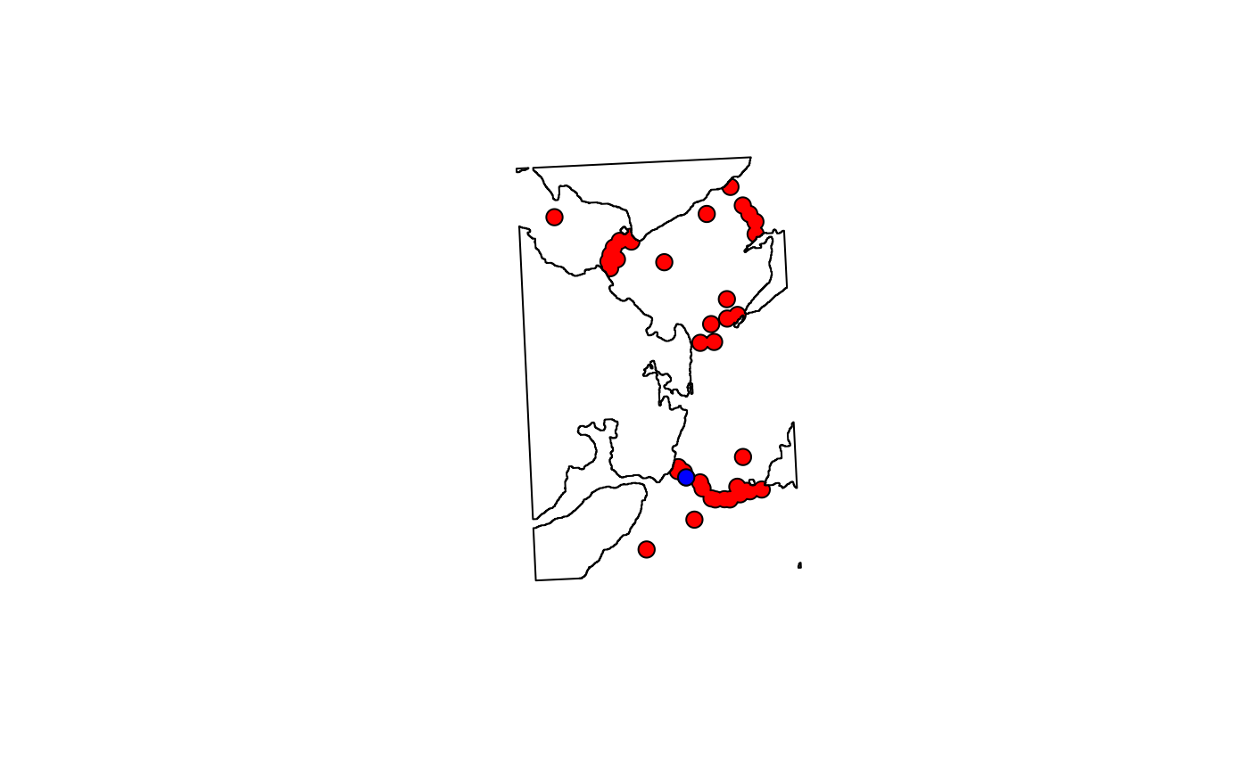
raster::plot(dat_coast)
raster::plot(sp_1[1], add = TRUE, col = "red") # single feature
raster::plot(sp_2[1], add = TRUE, col = "blue") # isolate specific features
sp_2
#> class : SpatialPolygons
#> features : 40
#> extent : 699188.2, 710830.8, 6249818, 6269558 (xmin, xmax, ymin, ymax)
#> crs : +proj=utm +zone=29 +datum=WGS84 +units=m +no_defs
# The total area of the former will be smaller, since areas covered
# ... by multiple receivers are merged
rgeos::gArea(sp_1)
#> [1] 16335577
rgeos::gArea(sp_2)
#> [1] 21992939
# But it can be more convenient to use the latter format in some cases
# ... because it is easy to isolate specific containers:
raster::plot(dat_coast)
raster::plot(sp_1[1], add = TRUE, col = "red") # single feature
raster::plot(sp_2[1], add = TRUE, col = "blue") # isolate specific features